Chapter 5
Tabular Data
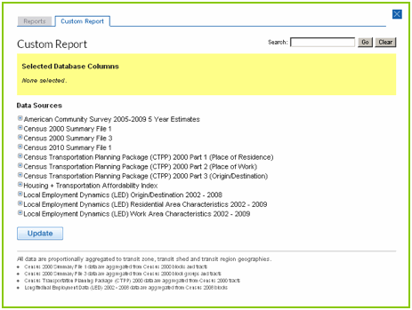
Available Data
The TOD Database utilizes nationally available data products that record demographic and travel behavior patterns. Six data products and data sets are currently available in the TOD Database.
US Decennial Census, 2000
- Summary File 1 (SF1) consists of counts and information on age, sex, race and ethnicity, household relationship and housing tenure. The SF1 data set is synonymous with the Census short form, prior to the US Census Bureau’s transition to sampling methods after the 2000 Decennial Census. While SF1 data is available at all Census geographies, the TOD Database aggregates SF1 variables from the Census Block because it is the smallest, most precise and accurate geography available.
- Summary File 3 (SF3) is a sample data set of detailed population and housing data collected from a survey. SF3 data is the result of the Census long form, which was last used in the 2000 Decennial Census. SF3 data consists of information on place of birth, education, employment status, income, as well as detailed information on housing units such as value of housing, mortgage and rental payments, and year the structure was built. Because SF3 data is a sample data set, the smallest available geography is the Census Block Group, which is used to aggregate data for the TOD Database. It is important to note that a variable from SF1 will return different results than that same variable from SF3 when using the TOD Database because the geographies differ and SF3 data results from sampling methods. Data sets cannot be mixed.
US Decennial Census, 2010
- Summary File 1 (SF1) consists of counts and information on age, sex, race and ethnicity, household relationship and housing tenure. Data is aggregated from Census blocks and tracts.
American Community Survey (ACS), 2005-09 5 Year Estimates
ACS is an ongoing survey that gathers detailed population and housing data every year. It replaced the long form of the Census. The 5 Year Estimates are rolling averages of data collected between 2005 and 2009. ACS data is aggregated from block groups and tracts.
Census Transportation Planning Package, 2000
CTPP is a special data product synthesized from the Decennial Census long form specifically for transportation planners. The TOD Database uses CTPP data products that were released in 2000. Now that the US Census Bureau has replaced the long form with the American Community Survey, updates to the CTPP are released annually. At present, CTPP using the ACS is only available as a 3-year estimate (2006-2008) at the PUMA level and as a 5-year estimate (2006-2010) at the Transportation Analysis Zone (TAZ) level. Both a PUMA and a TAZ are too large to accurately aggregate down to a transit zone so it is not included in the current release of the Database. However, when ACS data is made available at the Census Block Group level in 2011, CTOD will include it in the TOD Database. At this time, the TOD Database aggregates CTPP 2000 data from Census Tracts.
- Part 1 provides information on where workers live, as well as worker and household characteristics
- Part 2 provides information on where workers work, as well as worker characteristics
- Part 3 provides journey-to-work flow data. These data include an origin Census Tract, a destination Census Tract, and a count of workers (all workers and several cohorts of workers) that commute between those tracts. Because the TOD Database aggregates data to transit zones, transit sheds and transit regions, these data are not included in their origin/destination structure. Rather, median distances are derived for all Census Tracts (for both workers who live in the Census Tract as well as workers who work in the Census Tract), and these data are included in the TOD Database.
Local Employment Dynamics, 2002- 2009
LED is a voluntary partnership between the Federal Census Bureau and state labor market information agencies. LED exists under the Longitudinal Employer-Household Dynamics (LEHD) program of the US Census Bureau. The LED partnership offers several data products, one of which is OnTheMap, an interactive online map that allows the display of Workplace Area Characteristics and Residential Area Characteristics, and traces the origin and destination tracts between worker home and work. The TOD Database uses OnTheMap data that is available at the Census Block (using updated 2009 Census Block boundaries).
- Residential Area Characteristics provides information on where workers live, as well as worker characteristics
- Workplace Area Characteristics provides information on where workers work, as well as worker characteristics
- Origin/Destination provides journey-to-work flow data. As with CTPP Part 3 data these data are not included in their origin/destination structure, but, median distances are derived for all Census Blocks.
Housing + Transportation Affordability Index, 200
The Housing + Transportation Affordability Index (H+T® Index) is a proprietary model developed by the Center for Neighborhood Technology that models household travel demand. The H+T Index estimates household transportation expenditures at the block group level based on seven neighborhood variables and three household variables for 940 core based statistical areas. More information is available at htaindex.org. Block group H+T data (and Census derived housing data) is aggregated to the transit zone level. Transportation data is modeled for three household types:
- Regional Typical Household
- Regional Moderate Household
- National Typical Household
Derived Data Fields
There are a number of tables and fields in the Reports section of the Database that have been calculated and aggregated by CTOD during the Database development process that are useful for TOD analysis. A footnote at the bottom of each report describes how a field was derived. The footnote will provide the data set and field names as well as the formula. Some examples of date calculated by CTOD are:
Densities
The following density measures are calculated using the 2000 and 2010 Census data.
- Residential Area in Acres — For each census geography, where total households per acre is greater than or equal to 1
- Household Residential Density — Calculated from households per Residential Acre
- Population Residential Density — Calculated from population per Residential Acre
- Total blocks — count of census blocks that intersect transit zone. Block size is often used as a measure of walkability; the more blocks in a transit zone, the more walkable.
- Average Block Size in Acres — Calculated in GIS; another indicator of walkability
Data Aggregation
Census data is available at the block, block group and tract level. Most census geographies are not fully contained within a transit buffer, rather, they overlap. To apportion a variable within a tract, the TOD DB utilizes a script that calculates the area and fraction of overlap. The script associates each Census geography (i.e. tract, block, etc.) to the buffer it intersects through a unique ID. The script then calculates the percentage of the object area that is within the transit zone as well as the actual area (in acres). Lastly, the script proportionally aggregates up from each census geography that intersects the buffer.
Median Distances
Median distances are derived by calculating the distances between all origin and destination Census Tracts (for CTPP) and Census Blocks (for LED), and then aggregating the median distance from all distances for each origin and destination tract.