Chapter 6
Build a Standard Report
The TOD database allows users to view existing, planned and proposed transit stations in 54 regions across the US as well as reports detailing characteristics of the area surrounding these stations. Below are instructions on how to select regions; select transit agencies, lines and stations; and change report settings.
Selecting a Region
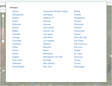
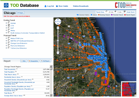
Stations can be viewed when a region is selected. Upon entering the site, the regions included in the database are listed. To go to a region, select its name from the list.
You can pan around on the map using the zoom bar and the hand tool. As the scale changes, so does the transparency of the transit region.
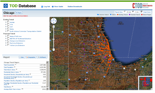
All existing, planned and potential transit stations (and their corresponding station areas) within the region are displayed and can be selected (see below).
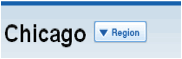
To change to another region press the Region button listed next to the name of the region currently selected.
If you move the map to display another region the information in the sidebar will automatically update.
Selecting a Transit Agency, Line or Station
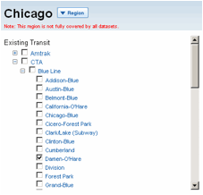
Once a region has been chosen, specific transit agencies, lines or stations within that region and their associated data can be viewed. Check the box next to the transit agency you want displayed, this will display all the agency’s stations. Multiple transit agencies can be selected at once.
To select a single line, click on the plus sign to the left of the transit agency’s name to expand the list. Plus signs to the left of the transit line names expand the list further and allow for the selection of specific stations. The map will automatically zoom in to center around your selection (unless the Smart Zoom box in the upper right-hand corner is unchecked).
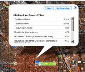
A blue box(s) will show up on the map representing the location of the selected station(s).
Clicking on the blue box brings up a dialogue box that lists the default report (Census 2010: Densities) for the transit zone. This dialogue box also gives the option of viewing the station from Google Streetview.
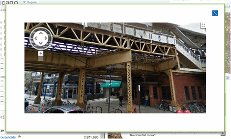
Clicking on the Streetview button brings up a Google Streetview window. The zoom bar and the hand tool can be used to manipulate the view and the entire window can be enlarged.
Searching for a Location
In the upper right hand corner of the map is a search bar. Type in an address and press the Search button. A list of potential addresses will appear.
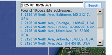
Select the desired address from the list and the map will zoom to that location. Additionally, a list of all the stations within 2 miles of the address will appear.
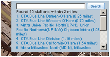
Clicking on a station from the list will center the map on that station. The station can then be selected.
Changing Report Settings
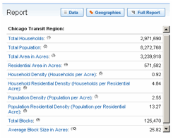
The Report settings are in the lower left-hand corner of the screen in the sidebar. When no stations are selected, data about the transit region is displayed. The default report is data on population, count of households and density.
The Report menu allows users to change the data displayed in the Report and to select the geography at which the data is displayed. The Data button, which can also be accessed from the selected station dialogue box, allows the user to choose the data to appear in the report.
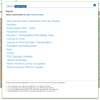
The Reports tab lists the standard reports that can be viewed. For instructions on how to create custom reports, please see Chapter 7 of the User Guide. To view a standard report, simple select it from the list; the dialogue box will close and the Report will update.
The Geography button brings up a window where the geography at which data displayed in the Report is chosen.
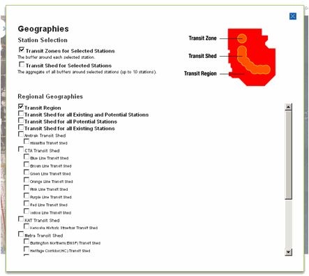
Please see Chapter 4 of the User Guide for a description of station geographies. Multiple geographies can be selected at a time. Once the desired geographies have been chosen, click on the X in the upper right-hand corner to close the window and the Report will reflect the selections made.
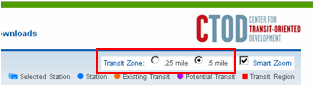
The size of the transit zone may be changed from a 0.5 mile buffer (the default) to a 0.25 mile buffer; the tool for changing the size of the transit zone is in the upper right-hand corner of screen.
The Full Report button on the Report menu expands the Report section and compresses the map. The full report view provides the user with an opportunity to download reports; downloading reports is discussed in detail in Chapter 8 of the User Guide.